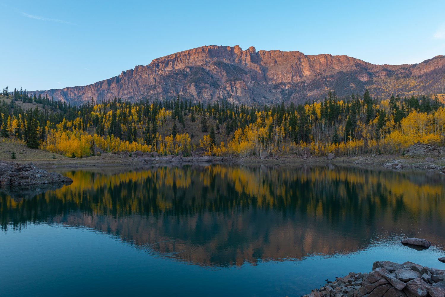
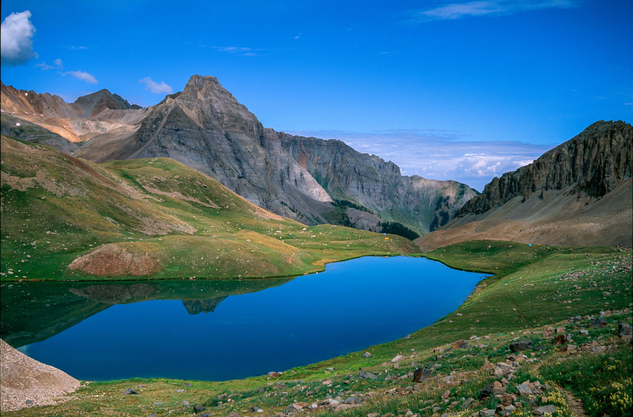
Upper Blue Lake sits between Ouray & Telluride, CO. It's about a 9 mile round trip from the trailhead with an elevation gain of about 3500 ft.
The Blanca Massif peaking out between the clouds after a snow storm.
This image was taken on the Rio Grande River on the northwest side of Alamosa, CO. Mount Blanca Massif caps off the view with majestic snow capped peaks & delightful magenta clouds.
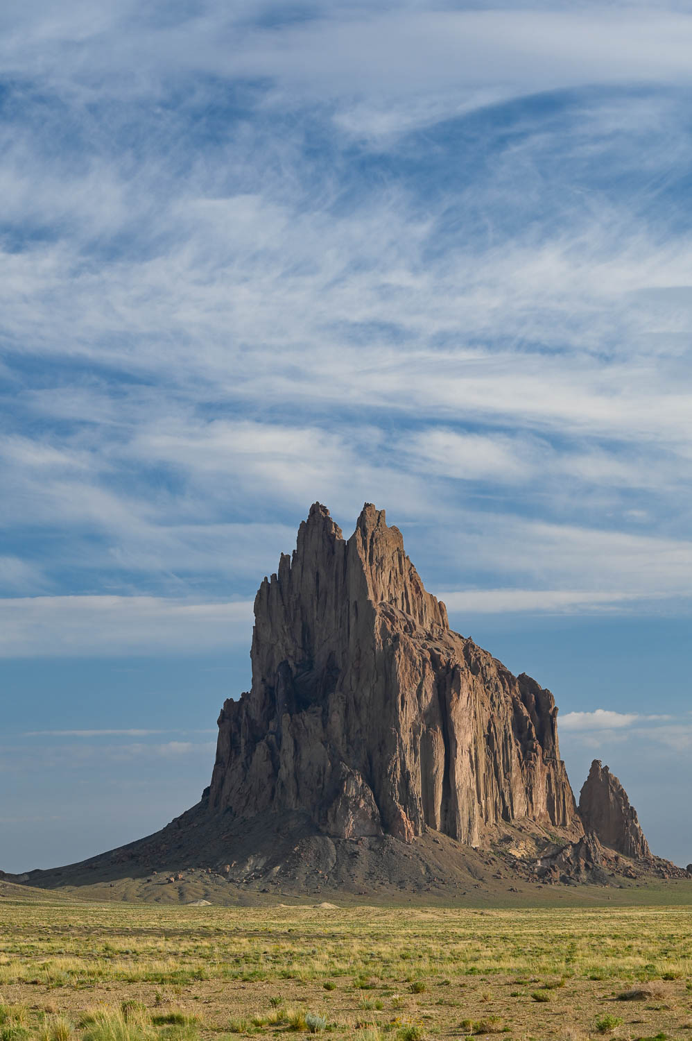
Shiprock is a monadnock rising nearly 1,583 feet above the high-desert plain of the Navajo Nation in San Juan County, New Mexico, United States. Its peak elevation is 7,177 feet above sea level.
Silver Falls is located between Wolf Creek Pass & Pagosa Springs on Forest Rd 667. It is a segmented horsetail falls leaping about 30' followed by a steep braided cascade of another 100'.
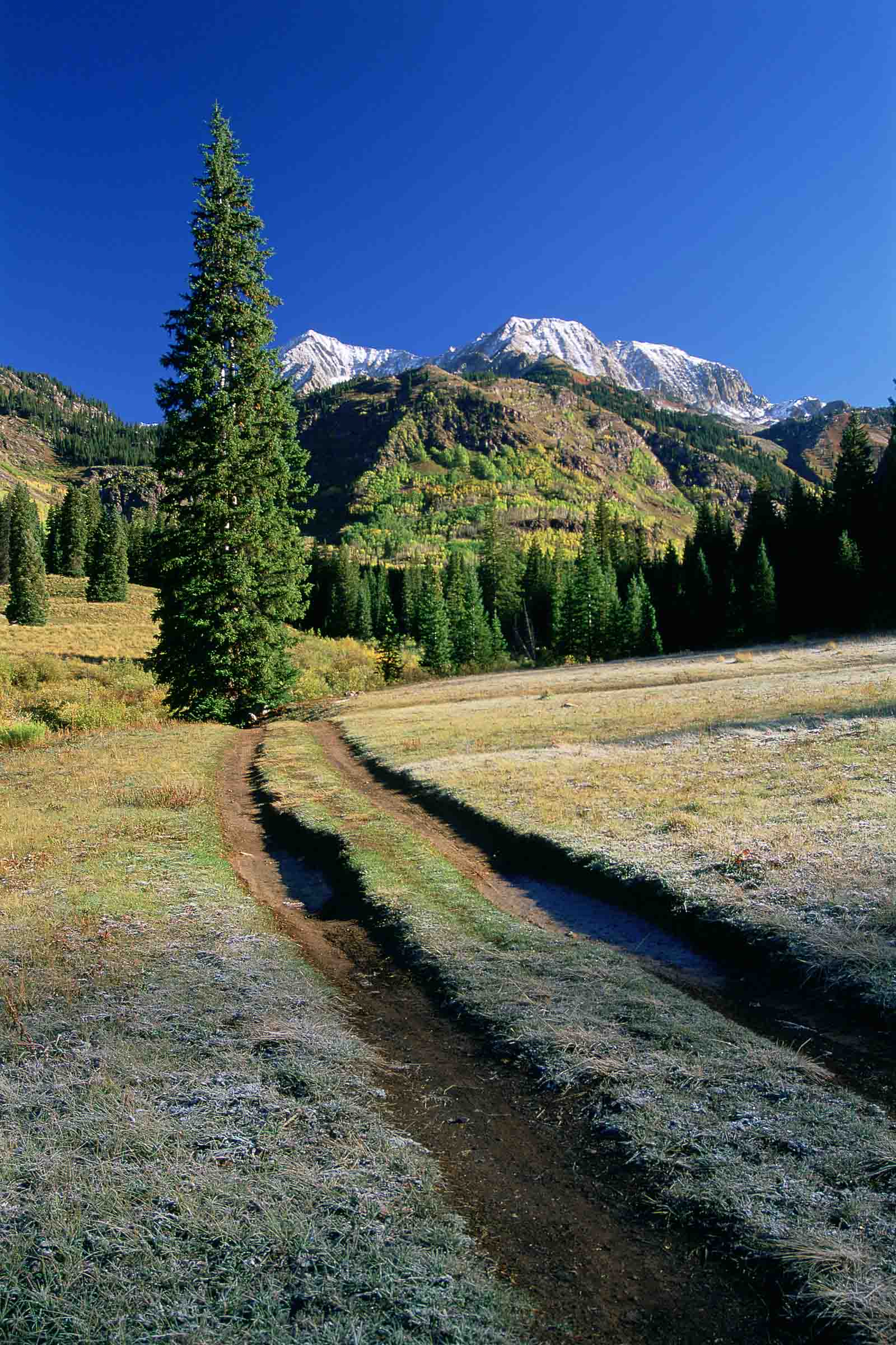
Snowmass Mountain is a 14,099-foot-high (4,297 m) mountain in the U.S. state of Colorado, and the thirty-fourth highest mountain peak in the state. Located in the Elk Mountains within the Maroon Bells-Snowmass Wilderness of the White River National Forest, it lies along the border between Pitkin and Gunnison counties, west of Aspen and southwest of the town of Snowmass Village.
Schwabacher Landing is a boat landing located a few miles south of Snake River Overlook, along the east shore of the Snake River in Grand Teton National Park, Wyoming, U.S..
Canoe's on the Snake River at Oxbow Bend
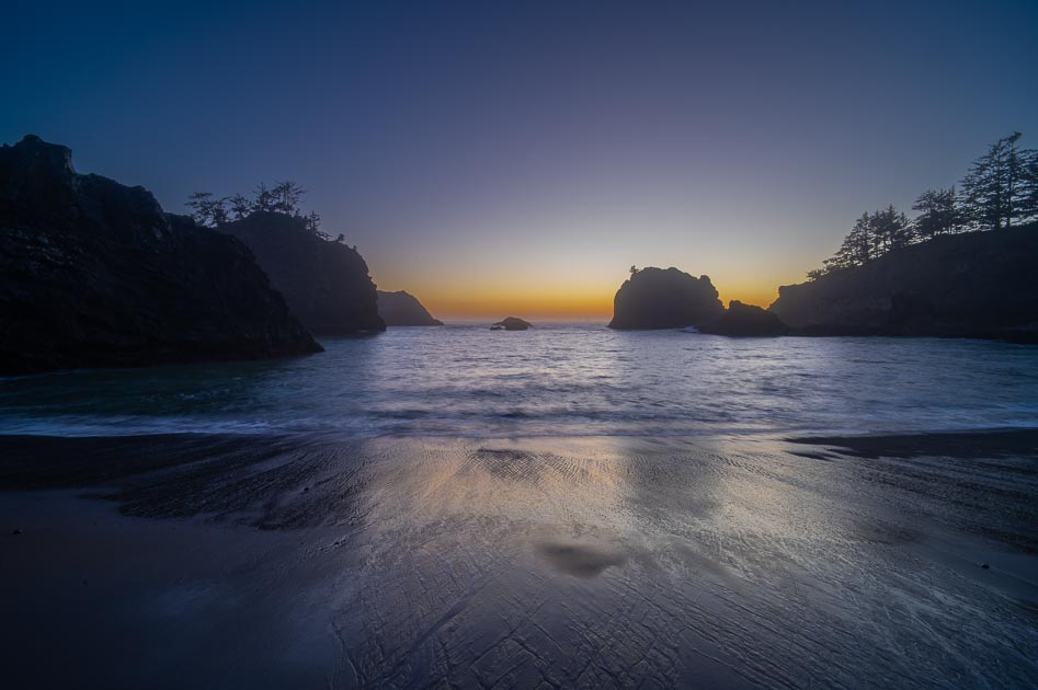
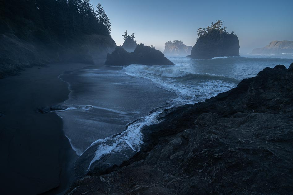
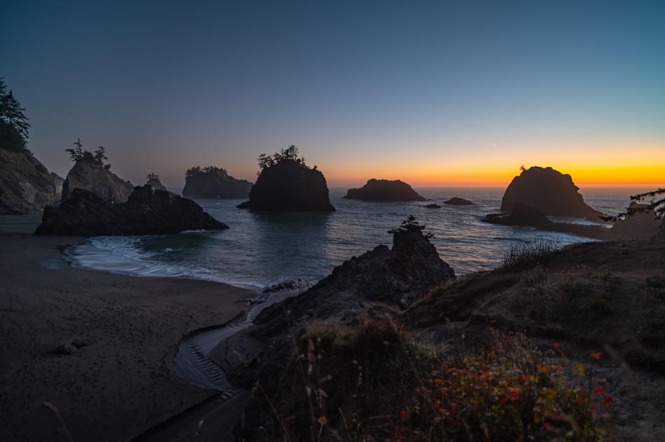
Secret Beach is in the Samuel H. Boardman Scenic Corridor in southern Oregon. It's not a secret just fairly secluded.
Multnomah Falls at 620' is the 2nd highest waterfall in the US. The falls are located between Portland and Hood River on the Columbia Gorge Scenic Highway. This little 2 lane road offers access to over 6 spectacular falls in as many miles. Legend has it that a maiden threw herself over the falls as a sacrifice to head off an epidemic. Now when the breeze blows through the water, a silvery stream separates from the upper falls, framing the maiden's form as a token of the spirits; acceptance of her gesture.
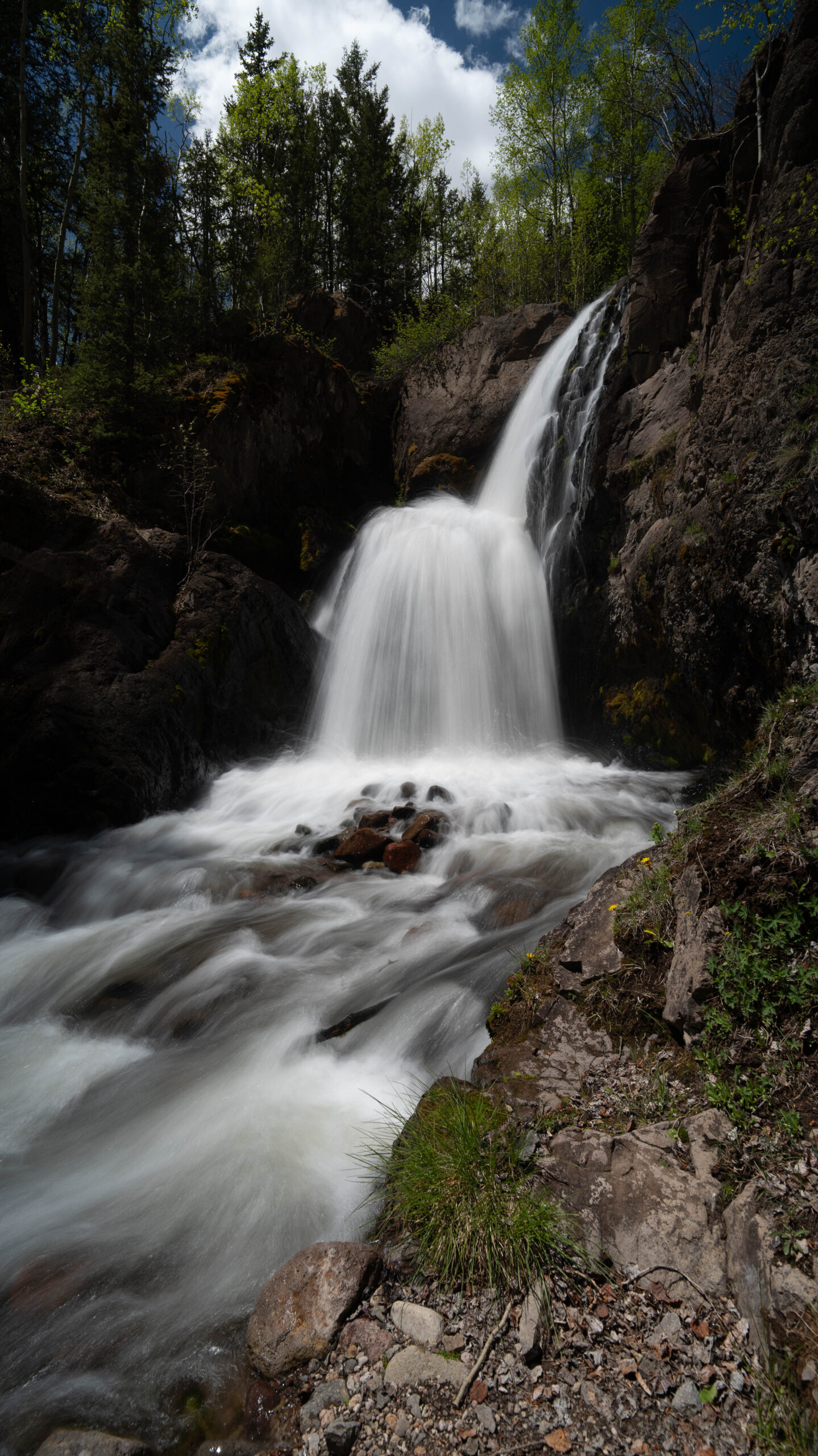
After a couple of attempts to find this falls I finally was able to locate it. The falls are about 3.5 miles west of the town of Jasper. This beautiful plunge fall drops 75 into a cliff lined pool' Be careful when visiting as this viewing point is at the top of a 90' cliff.
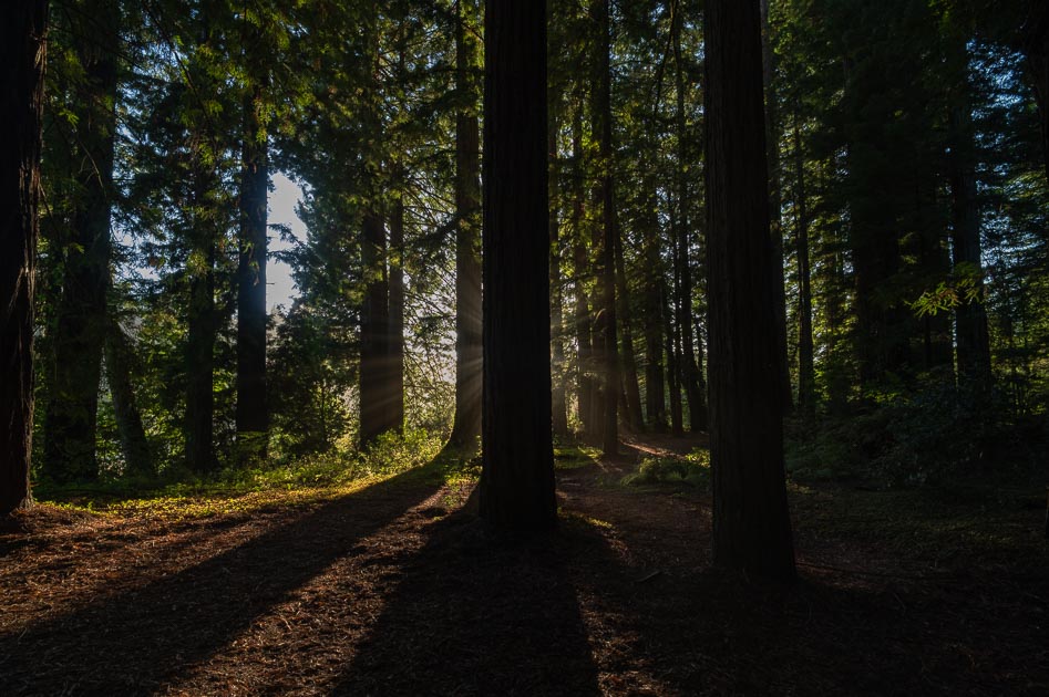
Captured this in the Jededia Smith Redwood State Park in California on my first day just before getting to the Oregon coast.
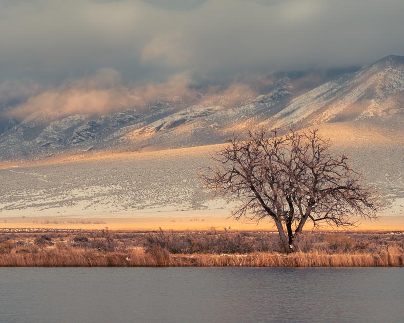
I visited the Blanca Wetlands NWR just after a snow squall was lifting out of the valley. I amazes me how the trees out here can weather the harsh conditions. The valley floor doen't get much snow accumulation but instead it receives more that it's share of bitter cold. Yet they survive
The Blanca Massif peaking out between the clouds after a snow storm.
This is a reconstructed Kiva used by the Ancestral Puebloan People
Angel Peak at sunset
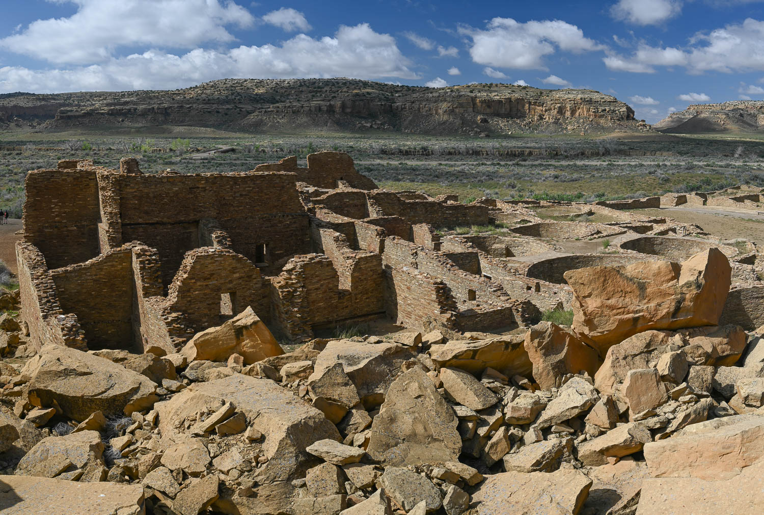
Pueblo Bonito
This image was taken from the north side of the river. Most images are taken from the south side at a rest area overlook. I prefer the look from this viewpoint as you don't have to compete with other people or crawl out on the rocky ledge to capture a photo.
Corona Arch, Utah, Sun Star, Sandstone, Canyonlands
Sunset in the Grand Canyon November of 2015
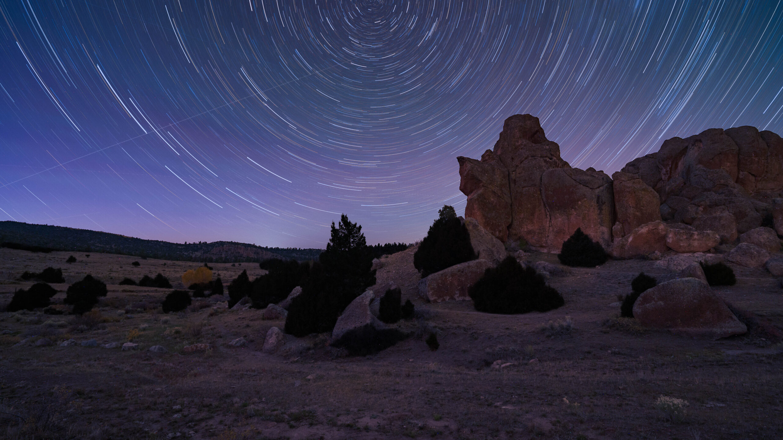
This is my first attempt at capturing star trails. This image is actually 4 15-minute exposures @ f/4.0 on a Viltrox 16mm lens, ISO 2500 with a Nikon Z6.
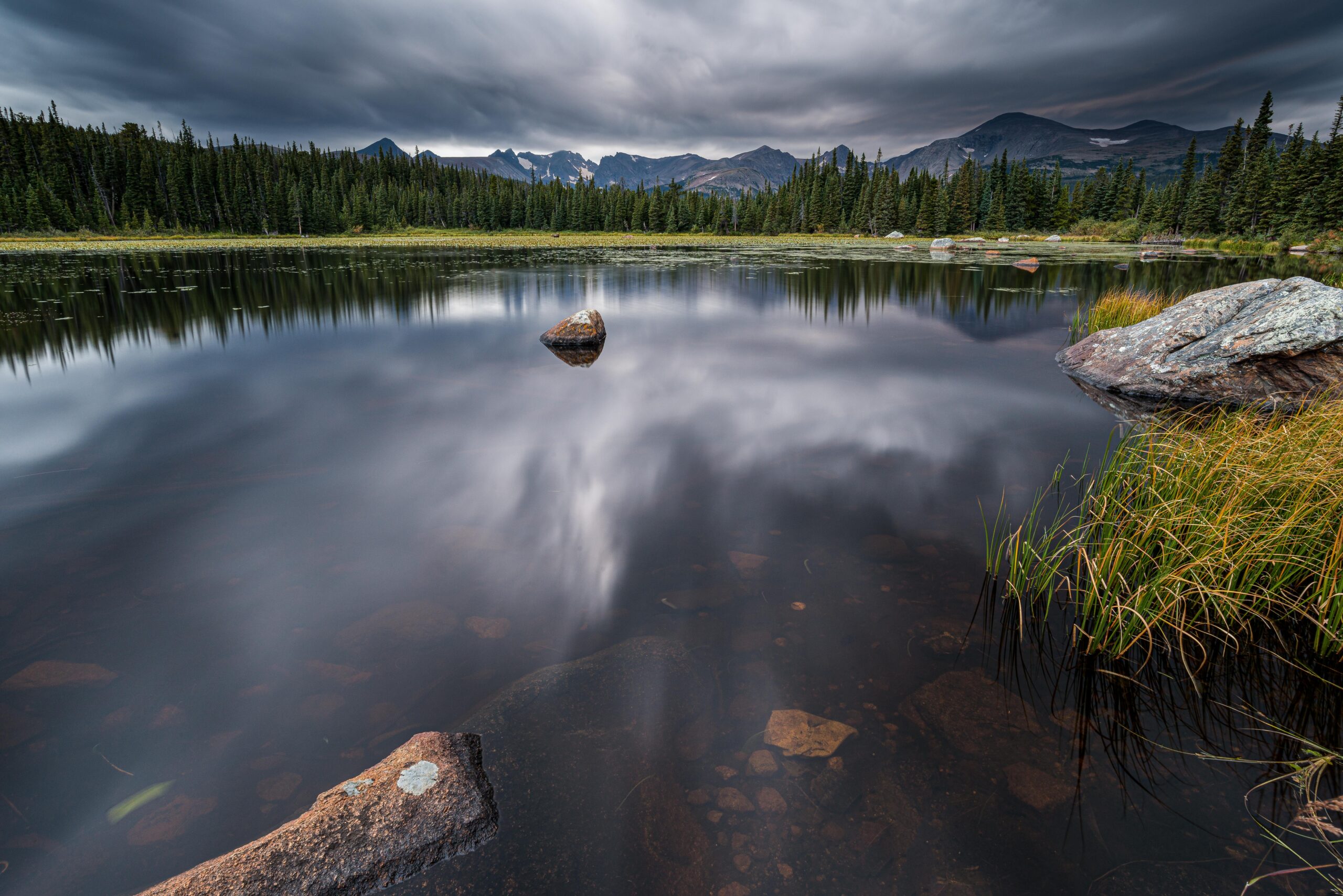
The lake is located in the Brainard Lake Recreational Area, near Ward, CO. I visited this small lake after shooting moose at Brainard Lake in the early morning. A storm was moving in & allowed for a really moody scene. At the far side of the lake, just left of center, a cow moose is grazing on the plants near the edge of the lake.
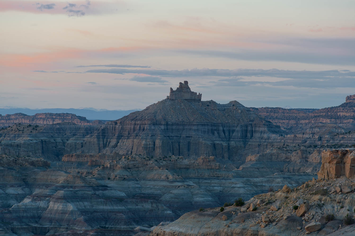
This is either an alien spaceship or a petrified Yoda.
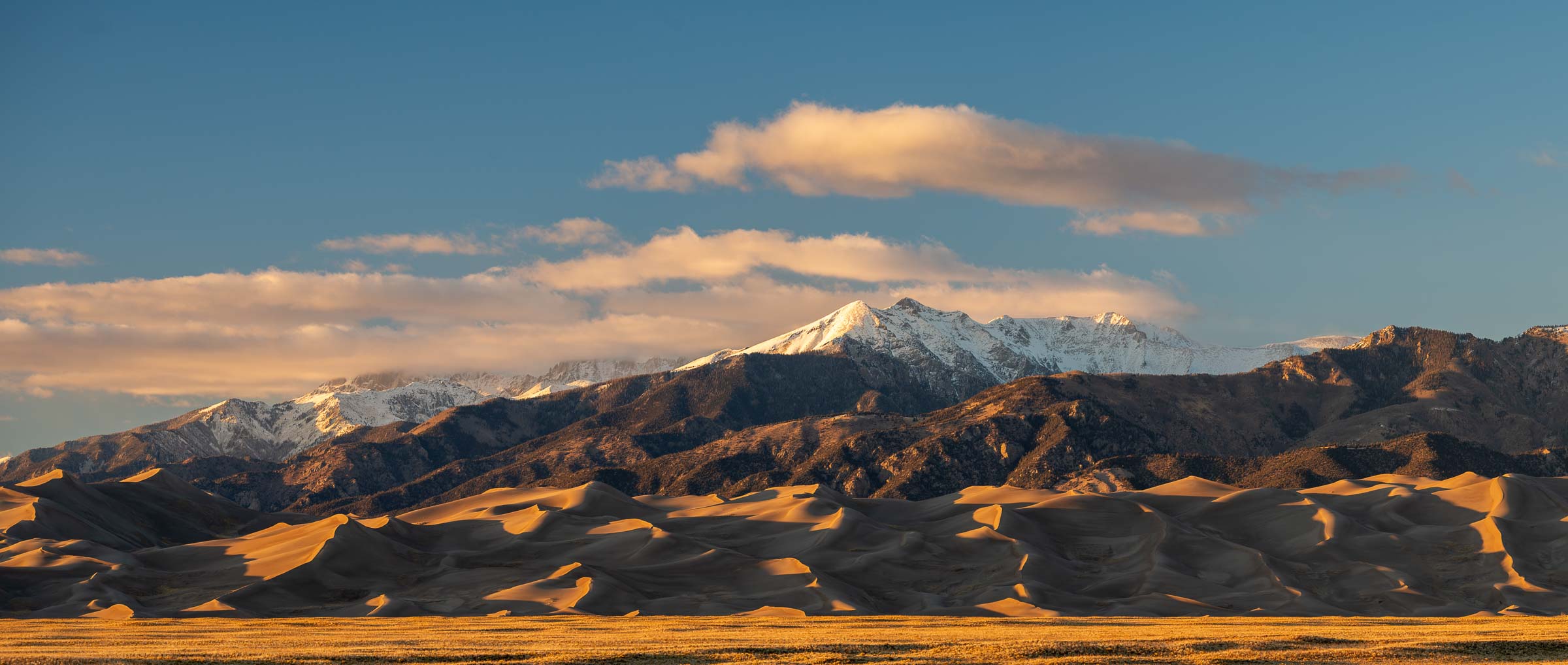
The park contains the tallest sand dunes in North America, up to 750 feet tall. The dunes cover an area of about 30 sq mi and are estimated to contain over 1.2 cubic miles of sand. Sediments from the surrounding mountains filled the valley over geologic time periods. After lakes within the valley receded, exposed sand was blown by the predominant southwest winds toward the Sangre de Cristos, eventually forming the dune field over an estimated tens of thousands of years. The four primary components of the Great Sand Dunes system are the mountain watershed, the dune field, the sand sheet, and the sabkha. Ecosystems within the mountain watershed include alpine tundra, subalpine forests, montane woodlands, and riparian zones
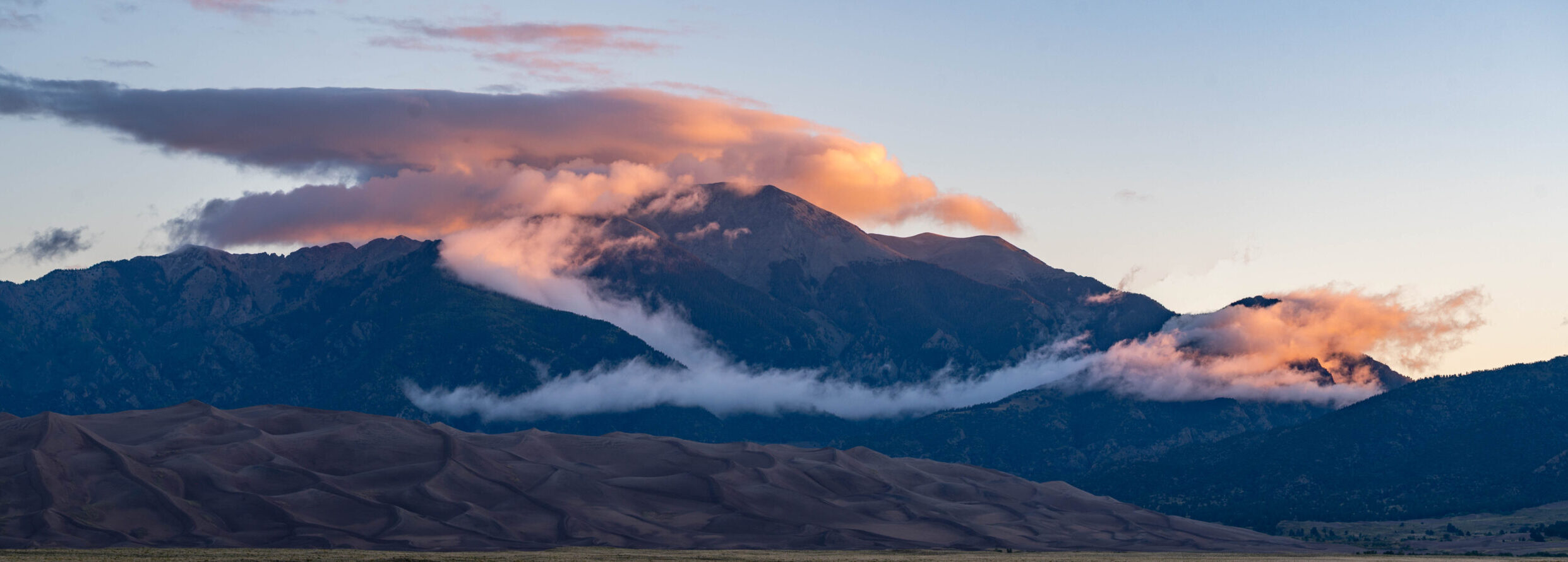
Early morning visit to the Great Sand Dunes NP for sunrise. The clouds were clinging to the valleys in the mountains behind the dune field.